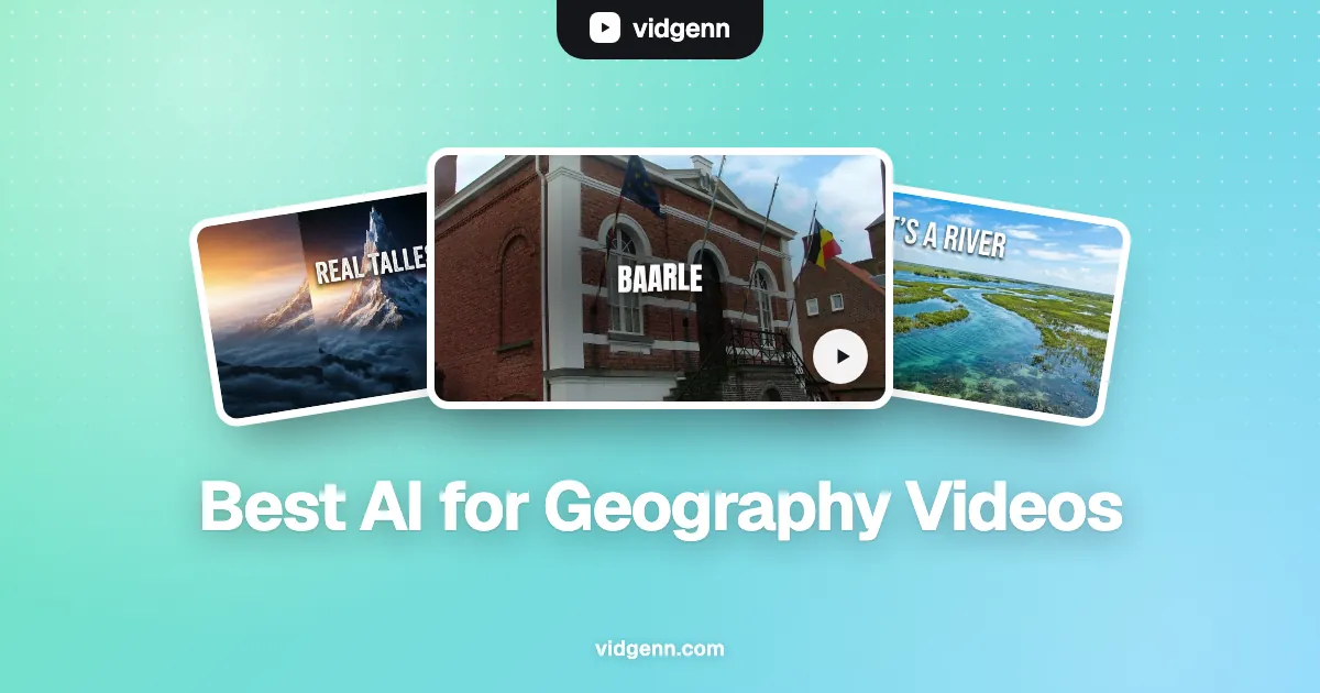
A geography video is a map with a story on top. "6 borders that make no sense", "why this town is in two countries", "the real tallest mountain on Earth": the viewer stays because every claim is shown on a map or in a real picture of the place, a few seconds after the narrator says it. An AI tool for a geography channel has to put the right map on the right sentence, and show the real place, not an invented one.
This guide compares six AI video tools for faceless geography channels. VidGenn, which publishes this guide, is one of them and is our pick for most map and place videos. You will also see where the others do better: longer videos, a free trial, or several video styles.
How we checked: every price and feature comes from each vendor's own pricing page on 6 November 2026, in US dollars, billed monthly. Minutes marked "about" are worked out from the vendor's own numbers. Prices change often, so check before you buy.
Quick picks
- Best overall for geography channels: VidGenn, with animated maps, routes and real footage of places from $19 a month
- Best for 30 to 60 minute country or region deep dives: VidRush
- Best for several styles (real footage, animation) in one tool: VidEdge
- Best if you want a free trial first: Pictory (14 days, 10 minutes)
- Best for research before you write: Subscribr
What a geography video needs from an AI tool
A map on the sentence that needs it
"The town of Baarle is split between the Netherlands and Belgium" takes one second to understand on a map and twenty seconds in words. Geography channels live on maps that appear exactly when the narrator names a place: a country highlighted, a pin on a town, a route drawn between two points with the distance on it. A tool that leaves you to build every map in an editor costs you the most time in this niche.
Real pictures of real places
Viewers of a place video want to see the place. AI-generated footage of a real city or mountain shows somewhere that looks plausible but isn't there, and geography viewers are quick to point it out in the comments. Real photos and drone footage of the actual place, with the source credited, keep the channel credible.
Map data you are allowed to use
Screenshots of Google Maps come with Google's own attribution rules, so most geography channels draw their own maps. Natural Earth map data is in the public domain, and Wikimedia Commons has free photos of most towns, borders and landmarks. NASA Earth images are generally free to use too. Our guide to copyright-safe documentary footage covers the rest.
Long enough to earn
Geography is part of the Education & Science group that had the highest median RPM ($10.22) in AIR Media-Tech's 2025–26 data, and YouTube allows mid-roll ads on monetized videos of 8 minutes or longer. A list of six strange borders makes a natural 8 to 12 minute video.
The six tools compared
| Tool | Starts at | Price per minute | Longest video | Visuals | Free trial |
|---|---|---|---|---|---|
| VidGenn | $19/month | $0.63 → $0.44 | 20 min | Licensed real footage + map and route graphics | No |
| VidRush | $99/month | $2.18 → $1.56 | 60 min | Real footage | No |
| VidEdge | $79.99/month | $2.10 → $1.55 | 30 min | Real footage, avatars, animation | No |
| Pictory | $29/month | $0.97 → $0.66 | 30 min | Getty and Storyblocks stock + AI images | 14 days, 10 min |
| Subscribr | $99/month | $1.50 → $1.20 | 3 hours | AI-generated, 14 styles | Free plan, no video |
| Vid.AI | $59/month | about $1.48 → $0.66 | 20 min (60 on Plus and Pro) | AI-generated video | No |
VidGenn: best overall for geography channels
VidGenn turns a topic such as "6 borders that make no sense", or your own script, into a finished 3 to 20 minute video. It writes title options and a researched script, narrates it with one of 24 ElevenLabs voices, and finds licensed footage of each place from Wikimedia Commons, Internet Archive, NASA, Openverse, Pexels and Pixabay. Every source goes into a credits file for your description.
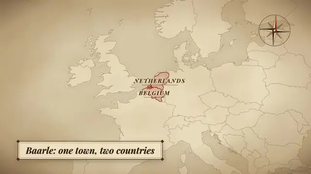
What makes it fit geography is the maps. When the script names a place, VidGenn can put a map graphic on that sentence: an antique-style map with the countries highlighted, a pin on a town, a globe zoom, or a route with the distance between two points. You can change any map's labels or swap any shot in the editor before you render.
- Best for: borders, countries, cities, landmarks, "why is this here" and "the real tallest" videos of 8 to 20 minutes.
- Good: the lowest price per minute here, real pictures of real places with a credits file, map and route graphics built in, and full control of the script.
- Watch out: no free trial, English only, and videos stop at 20 minutes.
Price: Starter $19 a month for 30 minutes, Creator $38 for 60 minutes, Pro $79 for 180 minutes ($0.44 a minute). See plans.
VidRush: best for 30 to 60 minute deep dives
VidRush makes long documentaries and Top 10 videos with real footage, from 6 to 60 minutes. A channel that publishes hour-long tours of a country or a region can make them from one brief.
- Good: videos up to 60 minutes; unused credits roll over (up to half a month's); 20% off yearly.
- Watch out: starts at $99 a month, about $2.18 a minute, with no free trial; refunds only if no credits were used.
Side by side: VidGenn vs VidRush.
VidEdge: real footage plus animation
VidEdge makes faceless videos in four styles: real footage, AI avatars, animation and musical, up to 30 minutes. A geography channel that wants some episodes as animated explainers and others with real footage can do both in one tool.
- Good: four styles, scripts and thumbnails in every plan, videos up to 30 minutes.
- Watch out: real-footage minutes start at $2.10 each, other styles give fewer minutes, and all charges are final.
Pictory: try it free with your own script
Pictory turns a script, article or link into a video with stock footage from Getty and Storyblocks, plus AI images. Stock libraries have plenty of famous cities and landscapes but few small towns or odd borders. If you already write your scripts, you can test it free for 14 days (10 minutes of video, 720p, with Pictory branding).
- Good: the only free trial here that makes real videos; up to 40% off yearly.
- Watch out: stock libraries have few small towns or odd borders; minutes are "up to" and go faster with AI visuals; no refunds.
Subscribr: research first, video second
Subscribr began as a YouTube research and scripting tool, with a database of 35 million videos, and now makes videos up to 3 hours long with AI-generated visuals. It suits a geography creator who wants help finding which place topics already work on YouTube.
- Good: research and scripts, a free plan for ideas, very long videos.
- Watch out: video plans start at $99, the visuals are generated rather than real pictures of the place, and all sales are final.
Vid.AI: generated scenes
Vid.AI makes long videos and Shorts with AI video models (Veo, Seedance, Kling), up to 60 minutes on its bigger plans. Generated footage can show a stylised landscape, but not the real town or border you are talking about. If you show realistic generated footage of a real place, YouTube asks you to label it as altered or synthetic.
- Good: cinematic generated scenes, Shorts as well as long videos, refunds on unused credits within 30 days.
- Watch out: generated pictures aren't the real place; starts at $59 with no free trial.
Example: a geography video made with VidGenn
Our "6 Borders That Make No Sense" example started from that one line. VidGenn wrote a script around six places, matched each to real photos (the town hall of Baarle, split between two countries; the US exclaves of Point Roberts and the Northwest Angle) and put maps on the places: the two countries that share Baarle highlighted, and a route between the two exclaves with the distance on it.
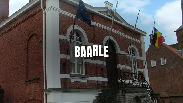
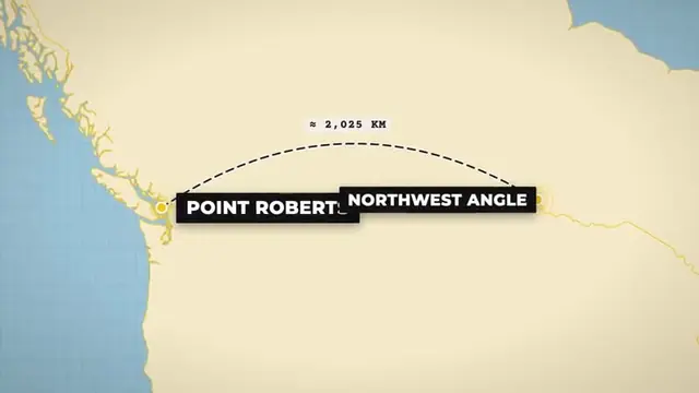
The same workflow fits "the real tallest mountain" (Mauna Kea, measured from its base on the sea floor), rivers, islands, capitals and "why nobody lives here" videos. Places with free photos on Wikimedia Commons are the easiest; private buildings and very remote places have the fewest pictures.
How to choose
- How long are your videos? Up to 20 minutes: VidGenn costs the least per minute. 30 to 60 minutes: VidRush. Longer: Subscribr.
- Do you need maps on every place? A tool that adds map, pin and route graphics for you saves the most editing time in this niche.
- Do you need the real place? For videos about real towns and borders, pick a tool that uses real footage (VidGenn, VidRush, VidEdge) over generated video.
- Do you want to try first? Pictory's 14-day trial is the only free way to make a full video here.
Make your first geography video
Common questions
What is the best AI for geography YouTube videos?
For most faceless geography channels, VidGenn: it puts a map, pin or route on each place the script names, uses licensed real footage of the place, and costs $0.63 a minute or less. For videos over 20 minutes, VidRush goes to 60.
Can I use Google Maps screenshots in YouTube videos?
Google allows some uses with its attribution shown, under its own guidelines, which change. Most channels avoid the question by using map graphics drawn from public-domain data such as Natural Earth, or a tool that draws the maps for them.
Where do I find free footage of places?
Wikimedia Commons for towns, buildings and landmarks; NASA for Earth from space; Pexels and Pixabay for landscapes and cities. Check each file's license and credit it.